As part of the course “Prototyping of interactive technologies, we were given the assignment to create an app that made use of the geolocation feature of a smartphone. Furthermore, it should not just be an app, you as a user should be able to interact and upload your own content on the map for others to see.
Challenge
The challenge showed out to get the app working technically while implementing the Google UI Kit. While the test of the prototype was build in FIGMA and tested in MAZE the final prototype was hardcoded, focusing on getting the Geolocation function to work.
Solution
The final product was CopenHere, which should explore the city of Copenhagen. The layout was simple focusing on the map function. The goal of the app is to make users share peculiar places around the capitol.
Initial Figma Prototypes
The App
Loading screen
Landing page
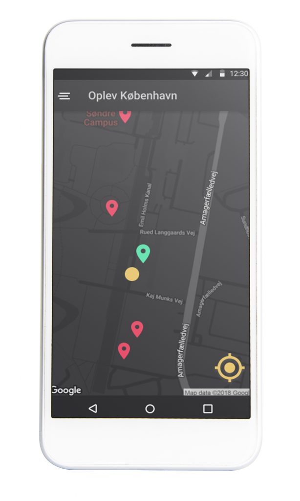
Closing in
Getting close to a certain area makes pins appear that you can interact with when getting close enough.
When taping on a pin, an information boxwill pop-up, displaying relevant information about the location.
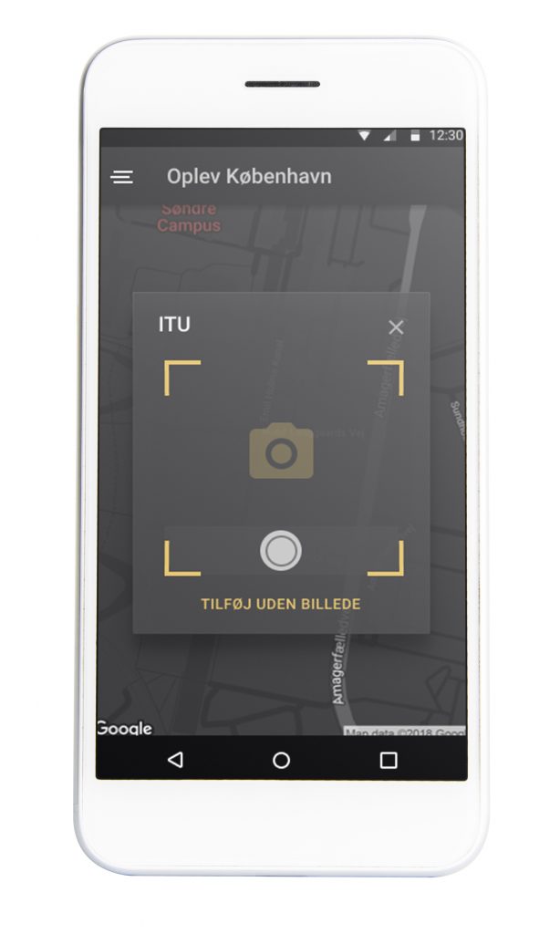
Pressing Tilføj enables the user to take a photo of the sight, uploading it to a collective database that others can add pictures to.
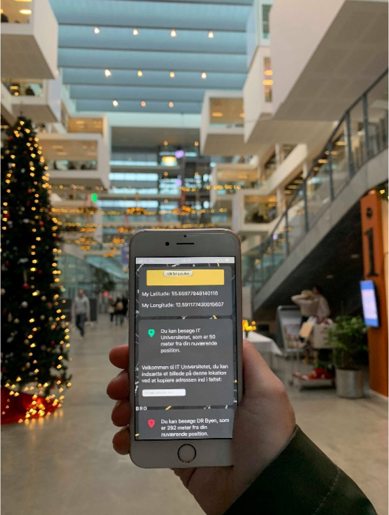
The App going live
Before the papers due date, we took the app for a spin. When getting close to a red pin, it would turn green and the user could upload a picture of the location.
The app worked both on iOS and Android and it was exciting to see the pins change colors. The app was a success.